Strong Winds, Hail and Tornadoes Possible in Michigan Tonight
Another round of potentially severe weather is expected across much of Mid-Michigan beginning early Wednesday evening through the wee hours of Thursday morning.
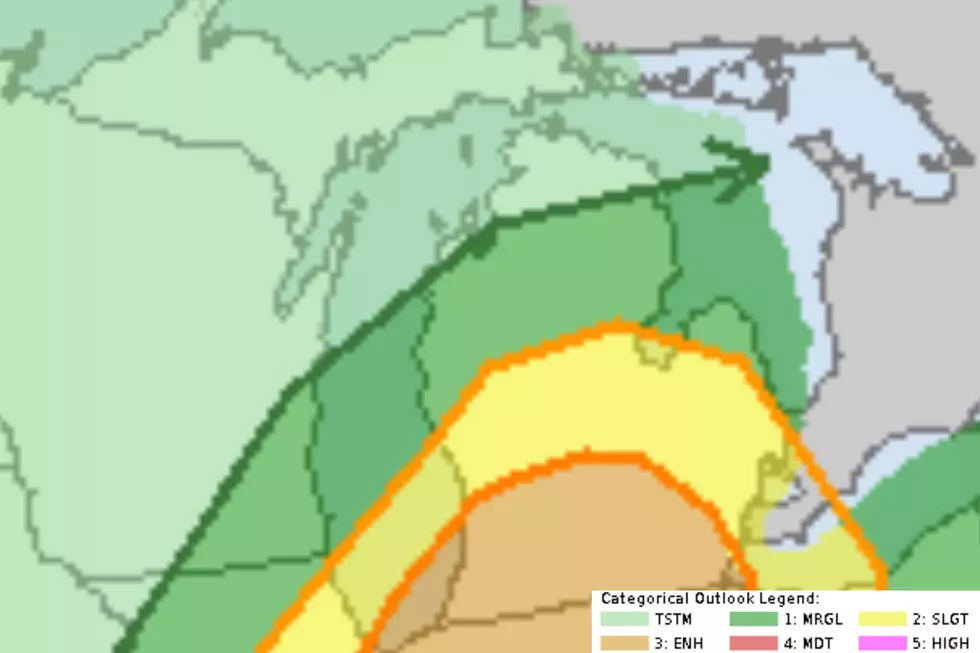
Forecasters with WILX News 10 in Lansing, the National Weather Service and AccuWeather all agree that strong to severe storms are likely, particularly in southern Lower Michigan.
Primary Threats from the Incoming Storms
The National Weather Service believes the greatest threat for severe weather in southern Lower Michigan is likely to occur along and south of the I-96 corridor.
The potential for storms to become severe will increase this afternoon, with the highest potential between 2 pm and 8 pm. The main threat will be strong winds, with a smaller chance of large hail, and an isolated tornado. ~ National Weather Service office in Grand Rapids
Forecasters with AccuWeather warn that flooding downpours, hail, damaging wind gusts and tornadoes can't be ruled out today and tonight.

WILX News 10 Meteorologist Justin Bradford says his primary concern would be from damaging wind gusts in excess of 60mph and localized flooding due to pockets of very heavy rain. Hailstones and even a tornado or two cannot be ruled out across the area today either, according to Bradford.

READ MORE: Early Summer Heat Wave to Hit Michigan With Multiple 90-Degree Days
Wider U.S. Threat Beyond Michigan
This evening's predicted storms in Michigan are at the northern end of a much larger weather system that could see severe storms fire off anywhere from western New York to Texas.
15 Michigan Counties at Most Risk of Tornado Damage in 2025
Gallery Credit: Dana Marshall, Canva and HomeGnome.com
These Are The 10 Deadliest Tornadoes In Michigan's History
More From 100.7 WITL